The landscape shaping Oshawa is defined by the deep ravines of the Oak Ridges Moraine and the steep bluffs overlooking Lake Ontario, where erosion-resistant till layers often overlie softer glaciolacustrine silts and clays. This geological inheritance, sculpted by the last glacial retreat, creates slope geometries that demand precise stability analysis before any excavation or foundation work begins. When a developer breaks ground near Oshawa Creek or the Harmony Creek valley, the factor of safety against sliding can shift dramatically with seasonal groundwater fluctuations. Our team approaches each Oshawa slope with a combination of subsurface investigation and advanced limit equilibrium modeling, incorporating the effective stress parameters derived from laboratory testing on undisturbed Shelby tube samples. For projects where deep-seated failure surfaces are a concern, we integrate findings from rotary drilling and SPT logging to define the stratigraphic contacts that often control instability in the region's overconsolidated deposits.
Stability in Oshawa's ravine slopes is governed by pore pressure response to spring snowmelt and the strength of sensitive glaciolacustrine clays—two factors no desktop study can quantify.
Our approach and scope
Local ground factors
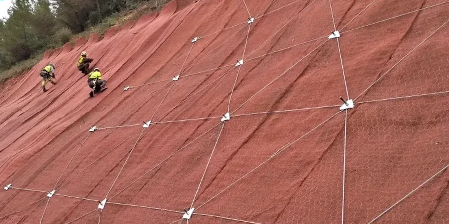
The most common and costly mistake we see in Oshawa involves cutting into a ravine slope without recognizing the presence of a confined sand lens within the till sequence. During spring, when the water table rises from snowmelt infiltrating the Oak Ridges Moraine recharge area, these lenses become pressurized. The resulting seepage force at the cut face can reduce the effective stress to near zero, triggering a retrogressive failure that propagates upslope far beyond the excavation limits. One incident near the Oshawa Creek floodplain required emergency stabilization after a 4-meter-high cut lost its toe support within 48 hours of exposure. Proper slope stability analysis—the kind that maps pore pressure anomalies with piezometer data and models transient flow—identifies these hazards before the excavator arrives. The cost of the analysis is negligible compared to the liability of a slope failure that undercuts adjacent infrastructure or sediment-laden runoff that violates the Ontario Water Resources Act.
Regulatory framework
NBCC 2020 (National Building Code of Canada, Seismic Hazard), CSA A23.3:2019 (Design of Concrete Structures, Earth-Retaining Provisions), MTO Slope Stability Design Guidelines, Ontario Regulation 166/06 (Development on Hazard Lands), ASTM D1586/D1587 (SPT and Shelby Tube Sampling)
Other technical services
Detailed Slope Stability Assessment
A complete package including borehole drilling, piezometer installation, CU triaxial testing on undisturbed samples, and 2D limit equilibrium modeling. Delivers a signed, sealed report with factors of safety for static, seismic, and rapid drawdown conditions, meeting the technical requirements of the Central Lake Ontario Conservation Authority.
Construction-Phase Monitoring & Inspection
We install and read inclinometers and standpipe piezometers during excavation near Oshawa's ravines, providing real-time data on slope movement and pore pressure trends. This service includes threshold-based alert protocols that trigger mitigation measures before movement reaches critical rates.
Typical parameters
Common questions
What triggers a slope stability study requirement in Oshawa?
Typically, a slope stability study is triggered when proposed development lies within the regulated area of a ravine or valley system, as defined by the Central Lake Ontario Conservation Authority (CLOCA) under Ontario Regulation 166/06. Steep slopes greater than 3:1 (horizontal:vertical) adjacent to Oshawa Creek, Harmony Creek, or the Lake Ontario bluffs almost always require a geotechnical stability assessment as part of the site plan application.
How do you model the effect of Lake Ontario on slope stability for Oshawa's lakeshore bluffs?
For bluffs along the Lake Ontario shoreline, we incorporate wave undercutting and toe erosion rates into the long-term stability model. The analysis uses a multi-stage scenario in SLOPE/W where the toe geometry retreats over a 50-year design life, combined with the highest recorded lake levels. This captures the progressive loss of passive resistance that leads to episodic bluff failures common east of Oshawa Harbour.
What is the typical cost range for a slope stability analysis in Oshawa?
For a single-family lot or small development adjacent to a ravine in Oshawa, the cost typically ranges from CA$1,460 to CA$5,030, depending on the number of boreholes, the depth of the slip surface investigation, and the complexity of the groundwater regime. Larger commercial or subdivision-scale assessments with multiple cross-sections and long-term instrumentation fall at the upper end or beyond this range.
Can you analyze an existing slope failure to determine the cause?
Yes, forensic slope stability analysis is a core part of our practice. We perform a back-analysis of the failed slope using the observed slip surface geometry and measured groundwater conditions, which allows us to calculate the mobilized shear strength at failure. This back-calculated strength is then used to design the remedial stabilization, ensuring the repair works with the soil's actual in-situ behavior rather than idealized laboratory values.
What stabilization options do you recommend for Oshawa's sensitive clay slopes?
For slopes underlain by the sensitive glaciolacustrine clays common in Oshawa, we typically evaluate a combination of slope regrading to a flatter angle, installation of trench drains to depressurize the slope, and in some cases, steel sheet pile toe walls where space is limited. The key is to prevent the undrained loading and strain softening that can trigger a sensitive clay flow slide, which is why we prioritize drainage over structural solutions where feasible. More info.