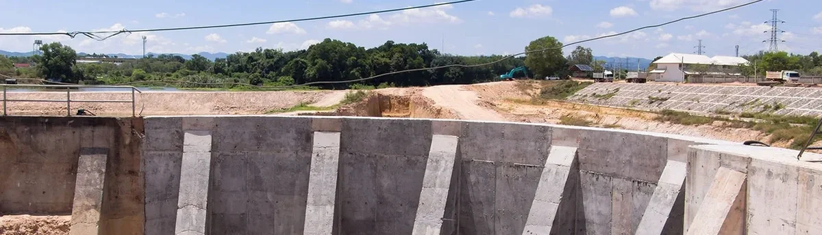
A string of vibrating wire piezometers, an in-place inclinometer chain, and a robotic total station with automated prism tracking form the core of a typical monitoring array deployed on an Oshawa excavation site. The city’s complex glacial stratigraphy—layers of Halton Till overlying sand and silt lenses—demands instrumentation that captures both pore pressure fluctuations and lateral deformation in real time. Our technical team configures these systems to stream data to a cloud-based dashboard, triggering alerts when displacement vectors approach pre-defined thresholds. For projects adjacent to sensitive infrastructure like the Oshawa Creek bridge or the GM assembly plant, this hardware-centric approach ensures that shoring walls and adjacent foundations remain within serviceability limits throughout the construction sequence. In deeper cuts where deep excavations encounter confined aquifers, we supplement standard arrays with multi-level vibrating wire piezometers to map vertical hydraulic gradients.
Real-time inclination data from Oshawa’s till deposits often reveals a 12-to-24-hour lag between dewatering drawdown and peak lateral displacement—a delay that manual surveying alone cannot capture.
Our approach and scope
Local ground factors
The transition from the Oak Ridges Moraine to the Lake Ontario shoreline creates a groundwater regime in Oshawa where artesian pressures can develop beneath the Halton Till aquitard. A dewatering-induced blowout at the base of an excavation is not a theoretical scenario—several projects near the Oshawa Creek corridor have encountered upward gradients exceeding 0.8. Our excavation monitoring framework in Oshawa addresses this through a nested piezometer network that tracks head differentials across the till-aquifer interface. If pore pressure data indicates a declining factor of safety against basal heave, we trigger a contingency protocol: immediate dewatering rate reduction, verification of the in-situ permeability assumptions used in the hydrogeologic model, and deployment of additional relief wells. The nearby Canadian Pacific rail corridor adds a vibration monitoring component, with triaxial geophones recording peak particle velocities to protect both the shoring system and the track bed from construction-induced settlement.
Regulatory framework
Ontario Building Code (OBC) – Excavation and Shoring provisions, CSA A23.3: Design of Concrete Structures – shoring wall references, ASTM D7299: Standard Practice for Verifying Vertical Inclinometer Probes, ASTM D6230: Standard Guide for Monitoring Ground Movement Using Probe-Type Inclinometers
Other technical services
Automated Total Station Monitoring
Robotic total stations with 360° prism tracking provide continuous 3D displacement data for shoring walls and adjacent buildings. Data is transmitted via cellular modem to a secure portal with configurable alarm thresholds.
In-Place Inclinometer Arrays
MEMS-based in-place inclinometer strings installed in grouted boreholes behind the shoring wall. Vertical deformation profiles are logged at 15-minute intervals, capturing the progressive development of shear zones in the till.
Vibrating Wire Piezometer Networks
Multi-level piezometer installations with barometric compensation. Pore pressure data is correlated with dewatering pump rates to maintain drawdown within the safe operating envelope specified by the hydrogeologic design.
Vibration & Crack Monitoring
Triaxial geophones and digital crack meters deployed on sensitive structures. Peak particle velocity limits are set per OBC and railway corridor requirements, with automated SMS alerts for exceedances.
Typical parameters
Common questions
What is the typical cost range for geotechnical excavation monitoring on an Oshawa mid-rise project?
For a typical 4-to-6-storey excavation in Oshawa with a 4-month monitoring duration, instrumentation supply, installation, and data reporting generally range from CA$1,000 to CA$3,290, depending on the number of inclinometer strings, piezometer levels, and whether automated total station tracking is required. Projects adjacent to rail corridors or heritage structures may require additional vibration monitoring, which is quoted separately.
Which Oshawa soil conditions most frequently trigger monitoring threshold exceedances?
The interface between the Halton Till and underlying sand lenses is the most common source of unexpected movement. When dewatering draws down the water table within a confined sand layer, the resulting consolidation settlement can cause differential movement in adjacent footings. Inclinometer data typically shows a distinct shear band developing at the lithologic contact, requiring immediate review of the excavation support design.
How does the monitoring frequency adapt during an Oshawa winter excavation?
Frost heave in the upper 1.0–1.2 meters of till can introduce a seasonal signal into settlement and inclinometer data. We establish a winter baseline during a 10-day freeze-stable period and apply temperature correction algorithms to vibrating wire piezometer readings. Automated total stations continue to operate in sub-zero conditions with heated enclosure kits, though prism cleaning frequency increases during freezing rain events common in the Durham Region.
What trigger levels are used for excavation monitoring alarms in Oshawa?
We typically set three-tier thresholds: advisory (70% of design movement), action (85%), and alarm (100%). For a cantilever soldier pile wall in Oshawa till, advisory might be 25 mm lateral displacement at the wall top, action at 35 mm, and alarm at 50 mm. Settlement triggers for adjacent structures follow OBC guidelines, with angular distortion limits of 1/500 for conventional buildings and 1/1,000 for sensitive facilities.