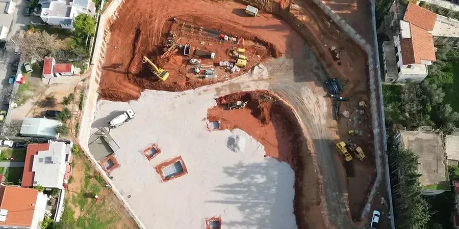
The National Building Code of Canada sets the baseline, but deep excavation design in Oshawa demands a granular understanding of what lies beneath the thin topsoil. Our team routinely works with the Port Hope and Whitby geological formations that dominate this part of Durham Region, where the interface between dense Halton Till and the underlying Queenston Shale creates a predictable yet unforgiving excavation environment. We have seen far too many projects where an overly simplified borehole log missed a perched water table in the sandy interbeds, and that error cascaded into a costly shoring redesign. Because Oshawa sits at roughly 106 meters above sea level on the Oak Ridges Moraine’s southern flank, the depth to bedrock can swing by several meters within a single block, and that variability is exactly why we combine core drilling with CPT testing to refine the soil profile before finalizing any temporary support system.
In Oshawa’s Halton Till, the apparent cohesion gives a false sense of security—once a fracture opens, the unloading rate controls the design, not the peak strength.
Our approach and scope
Local ground factors
The contrast between the south end near Lakeview Park and the north end around Conlin Road illustrates Oshawa’s two excavation personalities. South of Highway 401, the overburden is thicker, the till is more consistent, and the groundwater table sits relatively high due to the proximity to Lake Ontario—here the main risk is basal heave in a deep cut if the undrained shear strength of the lowest clay layer has been overestimated from a single field vane test. North of Taunton Road, the till thins rapidly and bedrock is close to the surface, but the shale is often fractured and water-bearing in the upper 3 meters, which means a rock cut that looks stable on paper can start spalling within 48 hours of exposure. In both settings, a nearby structure on shallow footings within a distance of less than twice the excavation depth triggers an immediate requirement for a detailed settlement analysis and likely a stiff shoring system with pre-loaded anchors to limit deformation to under 25 mm.
Regulatory framework
NBCC 2020 (National Building Code of Canada, Part 4), CSA A23.3-19 (Design of Concrete Structures – anchors and shotcrete facing), CAN/CSA-S6-19 (Canadian Highway Bridge Design Code – excavation support near bridges), ASTM D2487 (Unified Soil Classification System – soil description for design)
Other technical services
Shoring and Support System Analysis
We design soldier pile and lagging, secant pile, or diaphragm walls based on staged excavation sequencing. For Oshawa’s bouldery till, we specify drillable sections and assess the risk of refusal on individual soldier pile locations, adjusting the spacing and embedment depth to maintain a consistent factor of safety across the entire wall line.
Groundwater Control and Dewatering Plan
We model the transient groundwater flow using the actual permeability values from in-situ tests in the sandy interbeds. The dewatering plan includes well spacing, pump capacity, and settlement predictions for adjacent properties, and we coordinate with the Central Lake Ontario Conservation Authority where the excavation is within the regulated area of a watercourse.
Construction-Phase Monitoring Protocol
We define the trigger levels for horizontal and vertical displacement based on the building condition survey. Inclinometers are installed in the retained ground, and we specify the reading schedule—daily during active excavation, weekly during the lag phase—so the contractor has clear action thresholds if the wall deflection approaches 0.2% of the excavation depth.
Typical parameters
Common questions
What is the typical cost range for a deep excavation design in Oshawa, from investigation through construction support?
For a complete geotechnical design package—including a targeted site investigation, shoring and dewatering design, and construction-phase monitoring—the fee in the Oshawa area typically falls between CA$2,440 and CA$10,940. The spread depends on excavation depth, proximity to adjacent structures, and the complexity of the groundwater regime. A straightforward cut in open ground with no nearby buildings sits at the lower end, while a multi-level excavation in the downtown core with tieback anchors and a detailed settlement analysis will be at the upper end.
How does the Halton Till in Oshawa affect the choice of shoring system?
The Halton Till in Oshawa is a dense, overconsolidated silty clay with abundant cobbles and boulders. Its high undrained shear strength allows for relatively steep temporary cuts, but the presence of boulders complicates driven systems like sheet piles. We often prefer drilled soldier piles with a rock socket into the till or shale because the drill can core through or displace boulders that would refuse a driven section. The design must also account for the till’s brittle behavior: once the strain exceeds the peak strength, the drop to residual strength is significant, so we limit the allowable displacement to keep the soil in the pre-peak range.
Do you need to consider frost action for deep excavations in Oshawa?
Yes, and it is a detail that is sometimes overlooked in the rush to get shoring in place. Oshawa’s winter temperatures can drive a frost penetration of 1.2 meters or more into exposed clay faces. The freeze-thaw cycling in the upper portion of the cut can loosen the till and create a sloughing hazard behind the lagging. Our design for excavations that remain open through winter includes insulation specifications for the exposed face, more conservative bench widths at the crest, or a requirement to apply shotcrete facing before the first hard freeze sets in.