A recent five-story mixed-use development off Simcoe Street North ran into unexpected organic silts at just 2.1 meters depth—material that the preliminary desktop study had classified as competent glacial till. The contractor lost three weeks redesigning footings before our team mobilized an exploratory test pit to expose the stratigraphy directly. Oshawa’s subsurface is rarely uniform; the city sits on the transition between the Lake Iroquois beach deposits and the Halton Till plain, creating abrupt lateral changes that boreholes alone can miss. An exploratory test pit lets the geotechnical engineer walk into the excavation, examine soil fabric, measure joint spacing in the underlying shale, and collect undisturbed block samples where Shelby tubes fail. For projects within the Durham Region’s designated growth areas, this level of observational certainty often makes the difference between a foundation that performs and one that requires costly mid-construction redesign. We combine these visual assessments with companion grain size analysis to quantify the fines content that governs drainage behavior, and when trench stability is a concern in saturated zones we reference slope stability criteria from the Ontario Building Code to design safe benching angles before anyone enters the pit.
A single well-placed test pit in Oshawa's till-over-shale terrain reveals more about foundation risk than five borings in the wrong location.
Our approach and scope
Local ground factors
The risk profile for an exploratory test pit changes dramatically depending on which side of Oshawa's former Lake Iroquois shoreline your site occupies. South of Bloor Street, near the lakefront, the stratigraphy is dominated by near-shore sands and silts with a water table that can sit within 1.5 meters of grade—trench instability is the primary hazard, and unshored vertical cuts in saturated sand can collapse in minutes. North of Taunton Road, the Halton Till provides excellent stand-up time in excavation, but the real danger is misidentifying the contact with the underlying Queenston Formation shale. Weathered shale can look and feel like stiff clay in a test pit wall, yet it heaves and degrades when exposed to freeze-thaw cycles or moisture fluctuations. Our team addresses these site-specific hazards by designing pit layouts, benching angles, and groundwater control measures that match the actual soil behavior observed during excavation, not generic assumptions from regional maps. When fill materials of unknown provenance are encountered—common in the older industrial parcels near the GM assembly plant—we extend the pit footprint to trace the fill boundary and coordinate with environmental consultants for concurrent sampling without mobilizing twice.
Regulatory framework
CSA A23.3 – Design of Concrete Structures (sulfate exposure classes for buried concrete), ASTM D2488 – Standard Practice for Description and Identification of Soils (Visual-Manual Procedure), ASTM D6938 – Standard Test Method for In-Place Density and Water Content of Soil by Nuclear Methods, Ontario Building Code (O.Reg 332/12) – Part 4 structural design provisions referencing NBCC 2020, ASTM D1556 – Standard Test Method for Density of Soil in Place by the Sand-Cone Method
Other technical services
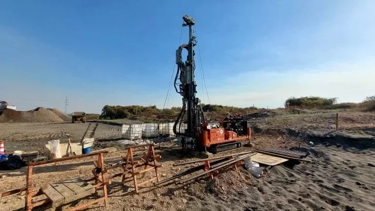
Stratigraphic mapping and foundation exposure
We position test pits to intersect critical foundation elements, exposing the bearing stratum for direct inspection, measuring in-situ density and moisture, and mapping lateral variability across the building footprint. Each pit face is logged at a scale sufficient to capture thin silt seams or cobble lenses that govern differential settlement.
Infrastructure trench assessment
For linear infrastructure corridors—watermains along Simcoe Street, storm sewers crossing Oshawa Creek tributaries—we excavate exploratory trenches to evaluate trench stability, rock rippability, and groundwater inflows. Our logs provide the geotechnical baseline for shoring design and dewatering system sizing under the Ontario Building Code.
Typical parameters
Common questions
What is the typical cost range for an exploratory test pit in Oshawa?
Most test pit investigations in Oshawa fall between CA$730 and CA$1,080 per pit, depending on depth, access constraints, and whether engineered shoring or groundwater control is required. Deeper pits in saturated sands south of Bloor may push toward the upper end due to the additional safety measures mandated by Ontario trenching regulations.
How do you handle groundwater in a test pit excavation?
We assess the stabilized groundwater level after a minimum observation period—typically 24 hours—and measure seepage rates at discrete horizons. Where inflows are significant, we use sump pumping or wellpoint dewatering to keep the pit floor dry for sampling and photography, always complying with Durham Region discharge requirements.
What is the difference between a test pit and a borehole for foundation design in Oshawa?
A test pit provides direct visual access to the soil fabric—you can see cobble orientation, fracture patterns, and oxidation zones that a 35 mm split-spoon sample will never reveal. Boreholes give you continuous depth and SPT N-values; test pits give you the geological context. Most projects benefit from combining both: pits for the upper 4 meters where footings sit, and borings to confirm what lies below.
How do you backfill a test pit to avoid future settlement?
We specify lift thickness and compaction criteria based on the native material and future surface loading. Typically, backfill is placed in 200–300 mm lifts and compacted to a minimum of 95% Standard Proctor density, verified by nuclear density gauge (ASTM D6938). For pits under proposed footings or pavements, we may use controlled low-strength material or flowable fill to eliminate post-construction settlement risk entirely.